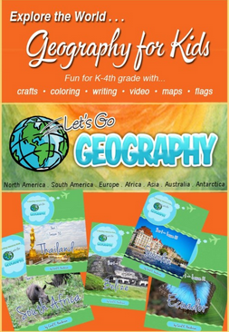
Learning about the place we live can be exciting for a young child, and it’s fairly easy to teach them. But what about teaching about places that are far away? That’s a lot trickier. A good homeschool geography curriculum is vital in that, and I have one to tell you about today.
Let’s Go Geography is a downloadable curriculum that offers a lot of hands-on activities, which is perfect for its target age demographic of grades K-4. Because my two older boys are outside the age range, Small Fry (K) and I have been learning about the world around us for the past few weeks. He’s barely at the point where he can differentiate the city from the state where we live, and definitely doesn’t understand about the countries yet, so his little mind is perfect for starting fresh with something like this.
 After you purchase the curriculum, you are given access to the site, where you can download the lessons. If you’re like me, you may not want to print the entire year’s worth at a time though. Let’s Go Geography sends you an automated email each week (at roughly the same day and time as when you first signed up – for me, this is on Sunday evenings), reminding you to get the new lesson ready, including direct links to the lesson (just log in to the site to access). I think that’s pretty neat! There’s no excuse for forgetting that way.
The Specifics of Let’s Go Geography
Each lesson covers a specific geographic area, and the first several lessons are all based on North America (Northeastern United States, Hawaii, Canada, Haiti, Nicaragua, and Belize are the first six, which is all I’ve gone through yet.) Each lesson is broken down into “chapters,” making it easy to divide the work up over a single school week. In order to get an idea of how the curriculum works, I’m going to go over the “chapters” in lesson 1 in a bit of detail.
Map It!
This chapter shows children what the country they’re studying looks like. Depending on the map you choose to download and print (there is one suggested and linked in the curriculum download, but it’s just a suggestion; ultimately, you’re responsible for finding your own map), it could also show them where the country is located in relation to the rest of the world also. Children are instructed to color the map. For older children, you could also have them label important parts (individual states, large cities, rivers, etc).
The Flag
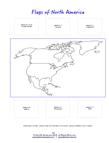 In this chapter, children learn to identify the flag of the country they’re studying that week. Included in the curriculum is a map of the overarching section of the study (in this case, North America and some of the nearby islands) with places to glue the flags. Students are also asked to draw a line connecting a flag to its country. Another option is to download the “passport” that goes along with the curriculum (an extra fee of $2.99, or go to the website and share about the curriculum on your favorite social media outlet to get it for free). Once you print out the passport and put it together, your child can glue the flags onto the correct pages of that.
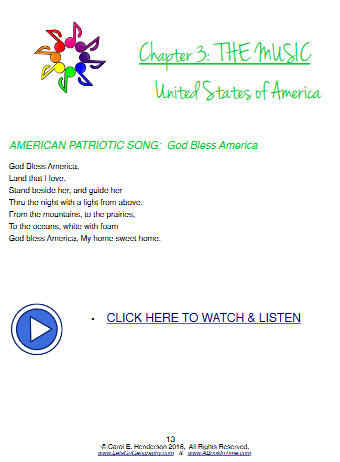
The Music
The music page in the Hawaii lesson. You can see that includes lyrics for the song as well as a link to hear the song. This is an example of a page that is better on the computer than in print.
This section provides links to listen to musical selections from the country. There are also lyrics for the national anthem.
Let’s Explore
In this chapter, there’s lots of information specific to the area you’re studying. In the Northeast U.S. lesson, students are taught about the geographical features specific to the region. This includes photographs of the region and short descriptions of what you might find there or things the area is famous for.
Create
This is a fun chapter – it provides a craft for the children that relates to the region. For the first lesson, children use a red Solo cup and printable flames (included in the curriculum) to make a lighthouse.
The final pages include a coloring page of the region and a notebooking page for older students to make a written record of what they learned during the week. (Due to the age of my student, we didn’t use the notebooking page, but he loves to color, so we did use the coloring pages.)
How We Used It
As I mentioned before, I used this curriculum with my Kindergartner. It was a bit intense for him to go at the rate of even one chapter per day, so we took it nice and slow, getting through one region approximately every two weeks. At this rate, it will take us 2 years (kindergarten and 1st grade) to get all the way through this curriculum, but that’s okay – I was blessed with lifetime access to the product (I’m not sure if this is the way it works for everyone, or if your purchase of the full year is good only for one year). I had him glue his flags onto the map I described earlier rather than into the passport, simply because the passport gave me a lot of grief in the printing process (which is not a problem with the file itself, just in that reloading paper into my printer and getting it to print correctly was a bit of a hassle). Also, I didn’t have any cardstock to make a good passport cover.
Right now, all of his papers are just kind of loose all around the school shelf, which isn’t ideal. I think I’m going to help my 5 year old to turn all of this great info into a lapbook pretty soon. This will keep it all very organized, but also make it much more interesting to look at, and will give him a keepsake to look back on when he’s older. The curriculum download includes several notebook cover options, one of which we will put on the cover of the lapbook. If you have an older student who would do better to keep his papers in a binder, you can use the cover printout in that way instead.
Final Thoughts
We’ve enjoyed working with Let’s Go Geography. I didn’t realize when I blindly printed out the first lesson that a lot of it is better used on the computer because it includes live links to things (the printable map, a YouTube video of the national anthem, etc). But some of it works just fine printed – in fact, some of the pieces have to be printed. So my advice is to spend the time on your computer going through each lesson in advance and printing just the pages that actually need to be printed.
You can get a full year of Let’s Go Geography for $21.99. If that’s a bit difficult for you to swing all at once, they also have a payment plan, wherein you agree to the whole year but make two equal payments of $12.99, one for the first semester and one for the second. If you’d prefer to buy just one semester at a time, the first semester is available for $14.99 (I didn’t see anything on the site about the second semester individually). There are also coupon codes available from time to time – currently there is a 25% off special going, but I don’t know how long that will last.
Blessings,